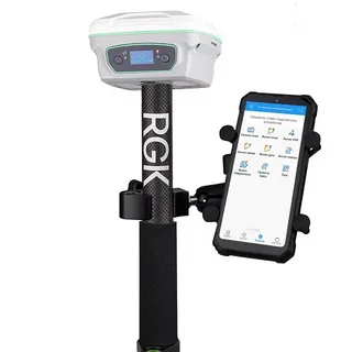
Global Navigation Satellite Systems (GNSS) have become an integral part of modern technology, enabling precise positioning, navigation, and timing services worldwide. Whether you use your smartphone’s map app, track a shipment, or conduct scientific research, gnss plays a vital role. This article aims at understanding GNSS: basics and applications, providing a clear overview of how this technology works and its diverse uses.
What is GNSS?
GNSS stands for Global Navigation Satellite System. It is a collective term for satellite systems that provide autonomous geo-spatial positioning. The most well-known GNSS is the United States’ GPS (Global Positioning System), but others include Russia’s GLONASS, Europe’s Galileo, and China’s BeiDou.
These satellite constellations orbit the Earth and transmit signals to GNSS receivers on the ground. By calculating the time delay from multiple satellites, a receiver can determine its exact position (latitude, longitude, and altitude) anywhere on the planet.
Basics of GNSS Operation
To fully grasp understanding GNSS: basics and applications, it is essential to know how the system functions:
- Satellite Constellations: Multiple satellites are placed in orbit, ensuring that at least four satellites are visible from any location on Earth at any time.
- Signal Transmission: Satellites continuously broadcast signals containing their location and the precise time.
- Receiver Calculations: The GNSS receiver captures these signals and calculates the distance from each satellite by measuring the time it took for the signal to arrive.
- Positioning: Using trilateration, the receiver computes its exact position by intersecting the distance measurements from at least four satellites.
Applications of GNSS
The range of applications for GNSS technology is extensive, spanning various fields and industries:
Navigation and Transportation
One of the most common uses of GNSS is for navigation in cars, aircraft, and ships. GNSS enables real-time route guidance, traffic management, and safety improvements in transportation systems.
Agriculture
Precision farming relies heavily on GNSS for activities like automated steering of tractors, soil sampling, and crop monitoring. This increases efficiency and reduces environmental impact.
Surveying and Mapping
Accurate land surveying and mapping use GNSS technology to obtain high-precision measurements. This data is crucial for construction, urban planning, and environmental monitoring.
Scientific Research
GNSS supports geophysical and atmospheric studies, including earthquake monitoring, weather prediction, and climate research.
Emergency Response
GNSS aids in disaster management by enabling quick location tracking of affected individuals and coordinating rescue efforts efficiently.
Future Trends in GNSS
As technology advances, GNSS systems continue to improve in accuracy, reliability, and availability. New satellite launches, enhanced signal structures, and integration with other technologies like 5G and AI are expanding GNSS capabilities.
In conclusion, understanding GNSS: basics and applications is crucial as this technology increasingly shapes many aspects of our daily lives and professional activities. From guiding drivers to enabling scientific breakthroughs, GNSS stands as a cornerstone of modern positioning and navigation technology.


